
While the Napa Valley might be better known for rolling vineyards and lots of wine, the region also features a wealth of breathtaking hiking trails for locals and visitors alike who are looking to get active. Here are six favorites from locals who lead hiking groups in the Napa area.
SKYLINE WILDERNESS PARK
Just about 10 minutes outside of downtown Napa, Skyline Park offers 25 miles of hiking trails, places to barbecue and bike. According to Visit Napa Valley, the two and-a-half main trail is good for hikers of all abilities, while a more difficult alternate route is available “for a better workout.” Both trails, along which hikers will catch glimpses of the San Francisco Bay and Marin Headlands, lead to Lake Marie. The trails offer minimal share, according to Gerry Parrott, who runs the Hiking with Pride group, so he tends to only visit in the fall and spring.
Skyline does require a pass for parking and/or biking or walking in, which can be purchased for between $3-6 on its website at skylinepark.org.
Address: 2201 Imola Ave. Napa, CA 94559
Hours: 7 a.m. – 7 p.m. (Spring/Summer), 7 a.m. – 5 p.m. (Fall/Winter)
WESTWOOD HILLS PARK
For a slightly easier hike, check out Westwood Hills. Most of the routes in the park are between two and three miles, according to Lisamarie Landreth, who started the Napa Valley Hikers group this spring.
“There’s a few different routes around, and it also offers a beautiful vista of both sides of Napa,” she said. Landreth suggested stopping into nearby Browns Valley Market for sandwiches or heading to Journey Coffee for a pick-me-up after the hikes. The Carolyn Parr Nature Center is also close by for kids who want more hands-on experience with some of the creatures on the trails.
Westwood Hills has free parking and lots of benches and tables for picnicking or resting before or after a hike.
Address: 3107 Browns Valley Rd, Napa, CA 94558
Hours: Sunrise – Sunset
MOORE CREEK PARK
Located east of Lake Hennessey, Moore Creek Park is another of Parrott’s favorites. He recommends the Valentine Trail, about a four-mile loop through the park. The 1,600-acre park has many other trails as well, some of which Parrott said are fairly easy for more amateur hikers. Be careful walking though, as the park is popular for bikers. Contact with the lake, a key source of drinking water, is not permitted at any time.
There are no fees to park or hike at Moore Creek.
Address: 2602 Chiles Pope Valley Rd, St. Helena, CA 94574
Hours: Sunrise – Sunset
BOTHE-NAPA VALLEY STATE PARK
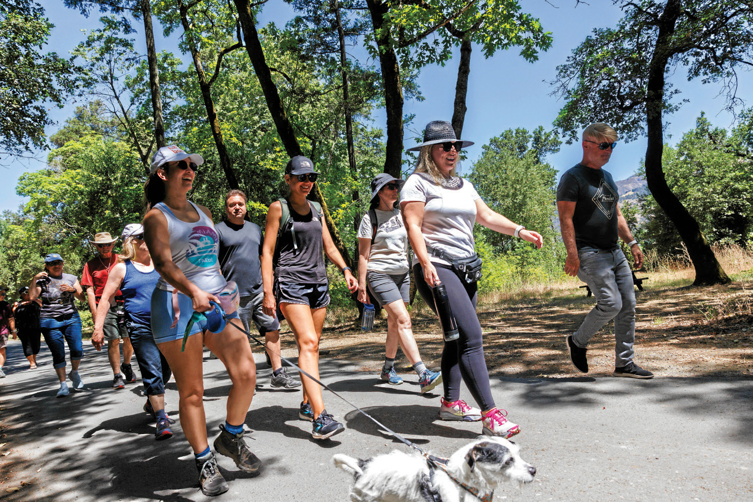
Further north along St. Helena Highway between St. Helena and Calistoga, Bothe Park offers a reprieve from all of the vineyards and wineries that line the valley. The park is full of redwood trees, creaks that span along the trails and even a swimming pool that can be accessed for an additional fee. Parrott’s favorite route is the Redwood Trail to Coyote Peak, but he said there are plenty of paths to take.
“One of the things that I love about it is that I would say probably about 80% of it is under canopy. Even on a hot day, you can still go up there and hike and not feel like you’re going to be completely exposed,” he said.
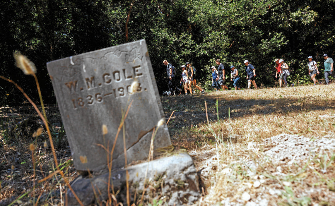
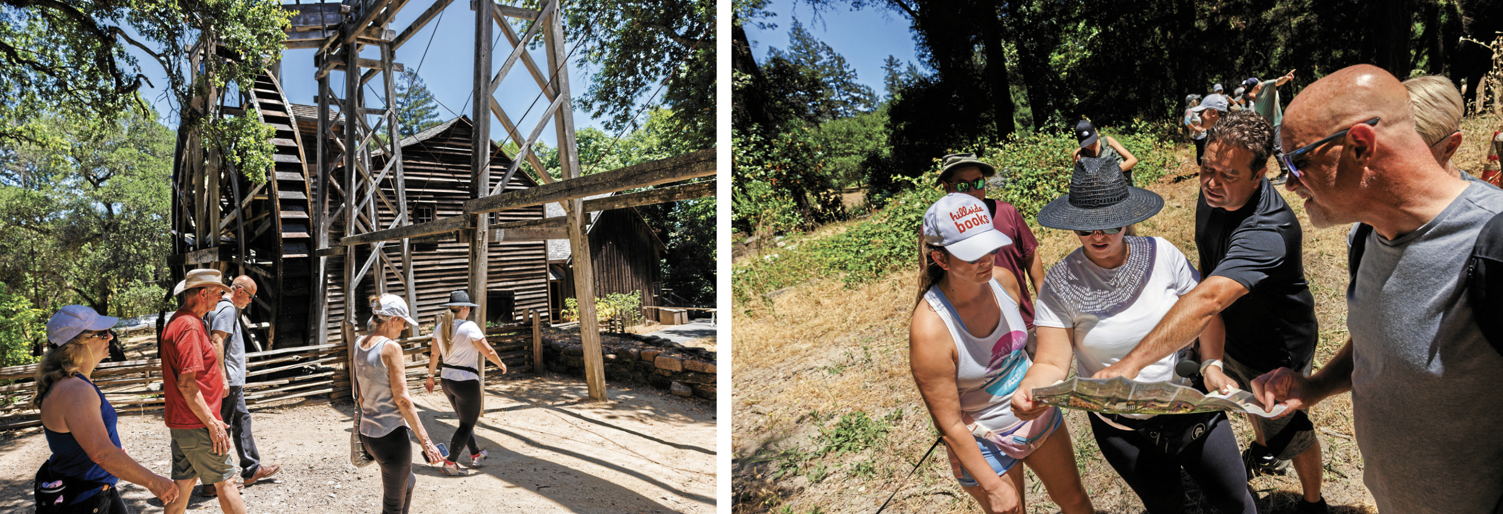
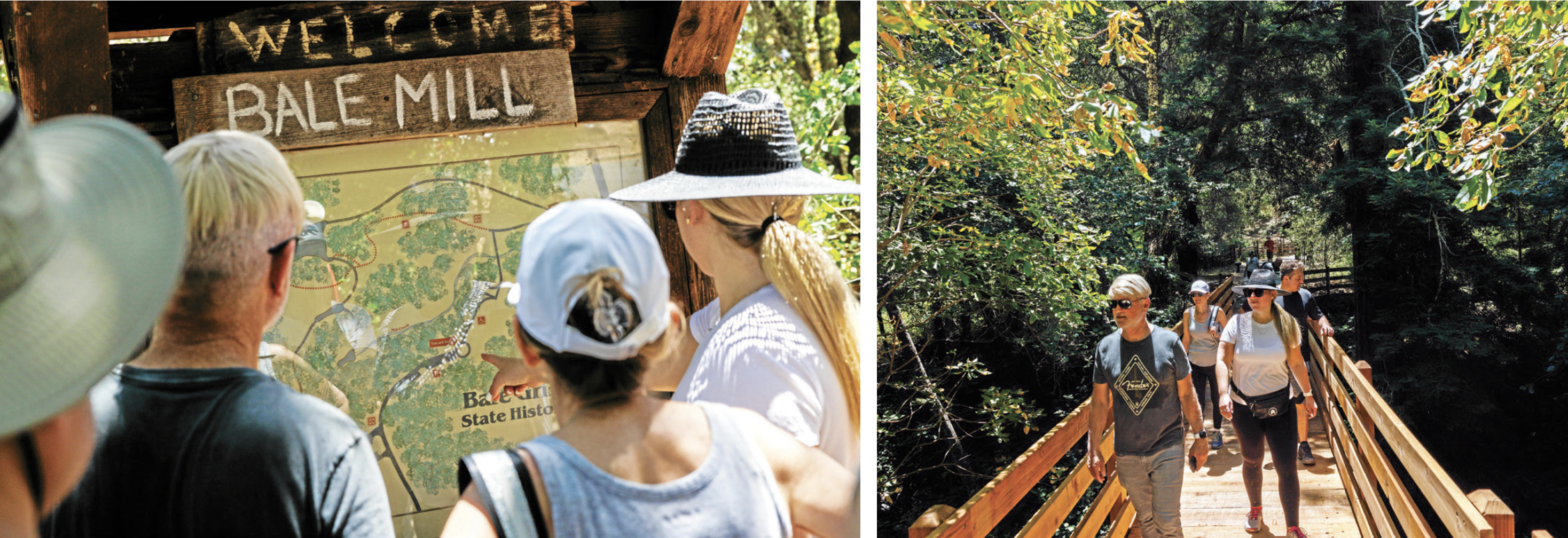
Another trail, recommended by Landreth, is the Bale Grist Mill history hike.
“You will see an old cemetery where members of the Donner Party are buried and some of the founders of the Valley are buried,” she said. “You can see all the history of the mill, and if you get really hot from hiking, you can jump in the pool after which is kind of fabulous.”
Parking is available for $10 per car, with lower rates for seniors and those with ADA accommodations. Hiking or biking in is free.
Address: 3801 St. Helena Highway, Calistoga, CA 94515
Hours: 8 a.m. – Sunset
TABLE ROCK TRAIL
Also in Calistoga, Table Rock Trail offers a more difficult hike. The route is pretty strenuous, with lots of rocky patches and up-and-downs — “I wouldn’t say it’s for the faint of heart,” Parrott said.
But the views are stunning — from the canyon where people have built labyrinths out of lava rock, to the peak of the hike, a southwest viewpoint of Calistoga.
“When you get up to the very top of Table Rock, no matter how tired you are or how much you’re cussing because your feet hurt, it’s so breathtaking,” Parrott said.
To access Table Rock, park in the Mount St. Helena Trailhead parking lot off of Highway 29 and keep south. The Alltrails app has a map and directions to the head. Unlike the other trails on this list, Table Rock does not have amenities like bathrooms or water fountains, so come prepared with lots of snacks and water.
Address: 4625 Lake County Hwy, Calistoga, CA 94515
Hours: Sunrise – Sunset
BARTHOLOMEW PARK
If you’re feeling more adventurous, Landreth also recommends heading over to Sonoma’s Bartholomew Park, her favorite hike in the area.
“You feel like you’re in an enchanted forest,” she said.
The privately-owned park features about a four-mile trail, and a winery if your group is itching to go wine tasting. Landreth recommended Sonoma’s Best, a nearby coffee shop and deli, for a posthike reward.
There is a parking lot for hikers located on Castle Road. Groups of more than eight will need to make reservations, and might not be accommodated during peak hours. To book a wine tasting for after your workout, visit bartholomewestate.com.
Address: 1695 Castle Road, Sonoma, CA 95476
Hours: 10 a.m. – 4:30 p.m. (trailhead closes) 6 p.m. (park closes)


